North Holland - Johannes Dou, 1729 by Johannes Dou
Scroll to zoom, click for slideshow

North Holland - Johannes Dou, 1729 1729

Johannes Dou

PapierDruck
86 ⨯ 112 cm
€ 3.250

Inter-Antiquariaat Mefferdt & De Jonge

  • Über Kunstwerk
    WALL MAP OF NORTH HOLLAND “’T Hoogheemraadschap vande Uytwaterende Sluysen in Kennemerlant ende West-Frieslant” [The Hoogheemraadschap (water board) of Uitwaterende Sluizen in Kennemerland and West Friesland], copper engraving after the design of Johannes Dou I, published in Amsterdam by Andries and Hendrik de Leth in 1729. Coloured by a later hand. Four sheets joined. Size: 86 × 112 cm. This map is a characteristic example of Dutch water management cartography. To protect the low-lying Holland polderland — situated in a deep basin — from the waters of the sea and rivers, a large number of waterschappen (water boards) were established throughout western Netherlands, each responsible for hydraulic works and flood protection within its district. For efficient water management, accurate overview maps were of vital importance. The Dijkgraaf (dike reeve) and High Heemraden (board members) of the water board of the Uitwaterende Sluizen in Kennemerland and West Friesland commissioned the surveyor and mapmaker Johannes Dou I (1615–1682) to chart their jurisdiction in the northern part of Holland. Dou spent an astonishing twenty years on the project, completing in 1682 an enormous map composed of sixteen sheets. Two years later, a reduced version on four sheets was produced, as well as a smaller single-sheet edition. All three versions of the map were engraved by Koenraet Decker (1651–1709), a pupil of Romeyn de Hooghe and Abraham Deur. Although their names appear only on the sixteen-sheet edition, it has been shown that the copperplates were reused and copied multiple times, both individually and in sets of three maps. While the cartographic content remained unchanged, small variations can be found in the coats of arms of the water board officials. Based on the heraldry on this particular copy — those of Dijkgraaf Aris van der Mienden, and Hoogheemraden Gijsbert Ramp, Claas Swaan, Cornelis van Eyck, Adriaan Warmenhuisen, and Rentmeester en Secretaris (land agent and secretary) Johan Baert — we can date this example to 1729. Johannes Dou I was admitted as a land surveyor by the Hof van Holland (High Court of Holland) on 10 September 1635. He studied at the University of Leiden, and after his father’s death in 1635 he was appointed, together with Steven van Broeckhuysen, as permanent surveyor of the Hoogheemraadschap van Rijnland. From 1637 onwards he also practised as a notary public. Literature: o.a. Donkersloot - de Vrij, Topografische kaarten van Nederland vóór 1750, p. 147-148, no. 751. Price: Euro 3.250,-
  • Über Künstler

    Johannes Dou, auch bekannt als Jan Jansz. oder Douw (Leiden, 7. Februar 1615 - 5. März 1682) war ein Landvermesser, der hauptsächlich für die Wasserbehörde von Rijnland arbeitete.

    Johannes Dou wurde 1615 (nach Angaben seines Vaters am 7. Februar) als Sohn von Jan Pieterszoon Dou und Josina Sadelaer in Leiden geboren. Am 8. März 1634 wurde Johannes als Student der Mathematik an der Universität Leiden eingeschrieben.

    Er besuchte Vorlesungen bei Frans van Schoten sen., Professor für 'Duytsche mathematicque', die Ausbildung für Ingenieure, Festungsbauer und Landvermesser. Sein Vater war ein bekannter Landvermesser mit einer großen Produktion, der auch mehrere Bücher über sein Fach veröffentlichte.

    Wahrscheinlich hat er seinem Sohn beigebracht, was er in der Praxis brauchte. Jedenfalls wurde Johannes am 10. September 1635 vom holländischen Gericht zur Ausübung des Berufes des Landvermessers zugelassen. 1637 wurde er zum Notar ernannt.

    Nach dem Tod seines Vaters im Jahr 1635 wurde Dou zusammen mit Steven van Broeckhuizen zum Landvermesser von Rijnland ernannt und trat ab 1637 auch als Notar in Leiden auf. Wie sein Vater war er äußerst produktiv, erreichte jedoch nie seine wissenschaftliche Größe.

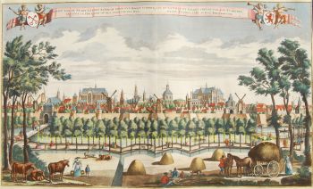
    Neben vielen kleinen Aufträgen zeichnete er sich auch mit einigen geschmackvolleren Arbeiten aus. Beispielsweise entwarf er 1661 den Kanal von Leiden nach Utrecht, wurde 1672 im Feldzug gegen die Franzosen eingesetzt und vollendete 1675 seine große Karte des Uitwaterende Sluizen.

Sind Sie daran interessiert, dieses Kunstwerk zu kaufen?

Artwork details