Amsterdam  by Hendrik Leth
Scroll to zoom, click for slideshow

Amsterdam 1783

Hendrik Leth

€ 2.250

Inter-Antiquariaat Mefferdt & De Jonge

  • Über Kunstwerk

    PLAN TRES EXACT DE LA VILLE FAMEUSE MARCHANDE D'AMSTERDAM. Copper engraving printed on two sheets by Hendrik de Leth, published 1783. Measures 57.5 x 88 cm. On 24 and 27 April 1734, the following advertisement appeared in the Amsterdamsche Courant: "Te Amsterd. By Hend. De Leth on the Beurssluys, is now published, an entirely new and accurate Plan of the city of Amsterdam, with many additions that were not found in any previous plans; decorated on both sides with the coats of arms of the Wel-Ed. en Groot Agtb. Heeren Burgemeesteren deezer stad, zedert de Reformatie tot nu, door voorname Liefhebbers keurig nagezien". One could choose between a rich version with family coats of arms and the coats of arms of the Amsterdam mayors on both sides, and a plain version without the coats of arms. This copy is the version without the coats of arms. Hendrik de Leth had made a reliable map amidst many competitors (such as Covens & Mortier), which was very useful in the city administration. The dignified French title seems destined for a more representative function, but for the rest the print is entirely in Dutch, which was convenient for the artisans and administrative users. Under the title we read "Gravée et mis au jour Par Henry de Leth a l'enseigne du Pecheur". This can be translated as "Engraved and updated to the present day by Hendrik de Leth under the label of Visser." The shop of publisher Nicolaes Visscher II kept this name, even after his death in 1702. Hendrik de Leth and also his father Andries worked in Visscher's shop when he was still alive. After Visscher's death his widow Elisabeth Verseyl continued the business until 1726. From about 1720, however, the daily management was in the hands of Andries. After he took over the business, he maintained the shop's well-known name. After his death in 1731, Hendrik, the son of Andries, took over. He too continued with the same shop name. The map is extremely clear and uncluttered, with only the main buildings standing out. Hendrik de Leth made the map after an older example and provided it with completely new decoration. An interesting difference between the map by De Leth and the earlier one is that De Leth gave the buildings engraved in the uprising a shadow. The sunlight here comes from the left, which corresponds to the eastern morning sun. To the left of the decorative, opening curtain, we see a Caarte van Amstelland. It is striking that in the legend block in the top right-hand corner, an I is mentioned after nine buildings. The legend explains this with the words NB Daar een I bystaat betekent Jansenisten. Jansenism, named after Cornelis Jansenius (1585-1638), was a religious and political movement from the seventeenth and eighteenth centuries that developed mainly in France as a reaction to certain developments in the Catholic Church and to the absolutism of the rulers of those days. The Jansenists' way of life was characterised by their ascetic rejection of the world and their pessimistic ethics. They also rejected, among other things, papal infallibility. The accentuation of the buildings on the map that had a relationship with Jansenism suggests that the engraver and publisher Hendrik de Leth adhered to this political movement. The central representation under the map is designed with care and taste. The title plate is beautifully incorporated into a group of figures, in which the city virgin is flanked by the two lions of the city arms and the river gods of Amstel and IJ, while Fortuna rises from the sea. The compass rose and ruler, like the title, have been given a three-dimensional shape as part of this grouping. The city seal and coat of arms above the map are carried by two angels. Literature: Marc Hameleers - Maps of Amsterdam 1538-1865, nr. 114 p.228-231 Price: Euro 2.250

  • Über Künstler

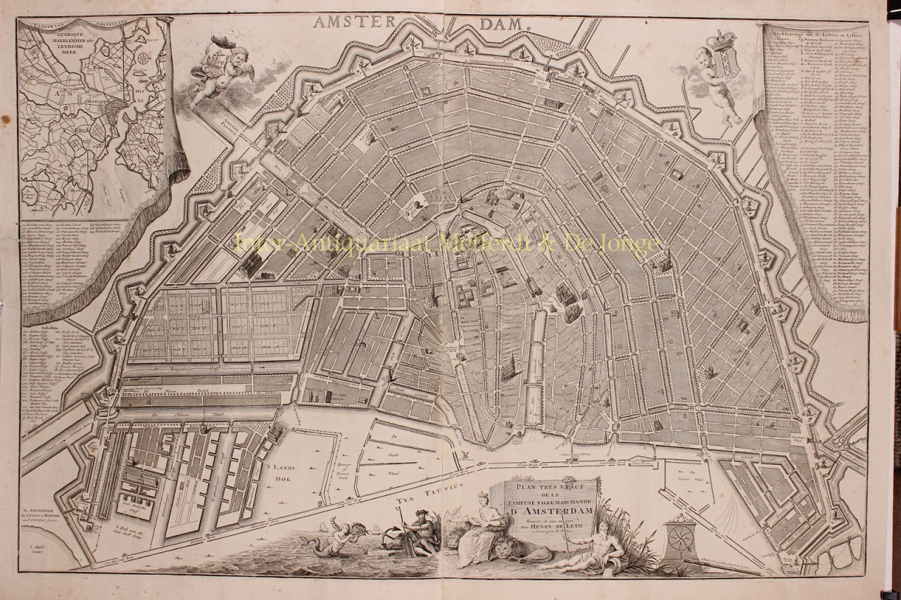
    Hendrik de Leth (* 31. Mai 1703 in Amsterdam; † 17. Juni 1766 in Amsterdam) war Druckgrafiker, Radierer, Kupferstecher, Kartograph, Zeichner, Buchhändler, Kunsthändler, Verleger von Drucken, Kunstsammler und Naturaliensammler.

    Hendrik de Leth war der Sohn von Andries de Leth (Plattenschneider, Buchhändler, 1662-1731) und Nelletje Middenheespen. Hendrik hatte einen älteren Bruder, Christiaan de Leth. 1742 heiratete Hendrik Sophia Otto, die 1753 starb. Ihre Ehe blieb kinderlos. Es war wahrscheinlich, dass Neffe Andries, Sohn von Hendriks Bruder Christiaan, der Nachfolger von Hendriks Geschäft werden würde. Er starb jedoch 1743. 1766 ließ Hendrik de Leth kurz vor seinem Tod ein Testament aufsetzen, wodurch Catharina le Blanc, die Enkelin von Bruder Christiaan, zur Erbin wurde. Am 30. September 1766 fand die Versteigerung seines Nachlasses statt.[3]

    1728 trat Hendrik der Buchhändlerzunft bei. Zuvor war er Schüler seines Vaters Andries de Leth, der die Karten-, Druck- und Kunsthandlung „Op de Beurssluys, in den Visscher“ in Amsterdam von dem Kartografen und Grafiker Nicolaas Visscher II. übernommen hatte. Hendrik de Leth wiederum übernahm diese Firma nach dem Tod seines Vaters im Jahr 1731.

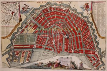
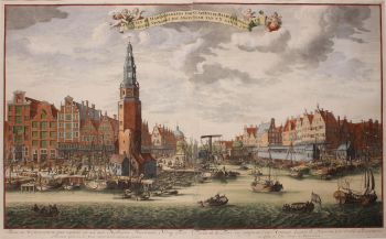
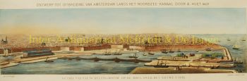
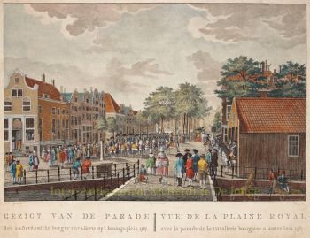
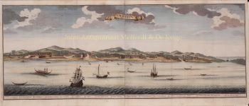
    Bereits 1725 wurde das Werk Images of the Wijdtvermaarde city of Amsterdam nebst seinen wichtigsten Buildings and Gesites veröffentlicht, alle exakt nach dem Leben gezeichnet und in Amsterdam veröffentlicht.

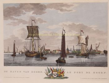
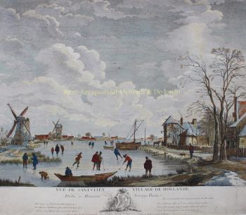
    Sein bekanntestes Werk mit 100 Drucken erschien 1730: Die segnende Pracht Kennemerlant : zeigt viele prachtvolle Gesichter seiner wichtigsten Lustorte, Adelshäuser, Dorf- und Stadtbauten : beginnend mit Kastrikum (...) / gezeichnet nach dem Leben und in dem von H. de Leth gebrachten Kupfer; und kurz beschrieben von M. Brouërius van Nidek. - Amsterdam : De Leth, 1730. Viele Drucke, die De Leth von Amsterdam gemacht hat, sind im Amsterdamer Stadtarchiv zu finden.

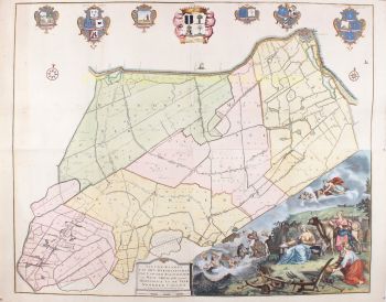
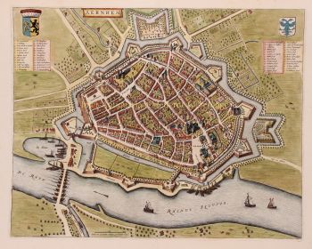
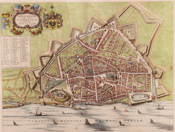
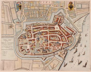
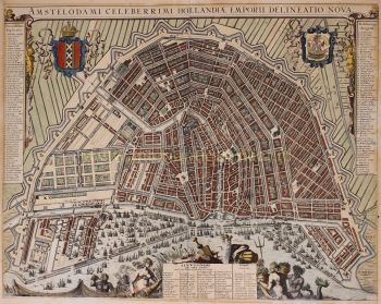
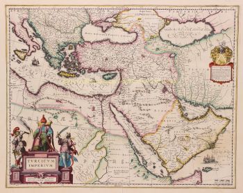
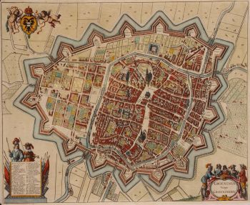
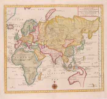
    Als Kartograph war De Leth vor allem für seinen 1740 veröffentlichten New Geographical Atlas und Historical Atlas, Van de Zeven Vereenigde Nederlandsche Provintien, bekannt. De Leth wurde auch durch die Kupferstiche bekannt, die er um 1758 von der Generalkarte der Kolonie oder Provinz Suriname nach dem Entwurf von Alexander de Lavaux anfertigte.

Sind Sie daran interessiert, dieses Kunstwerk zu kaufen?

Artwork details