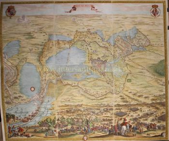
SEHR SELTENE ERSTE GEDRUCKTE KARTE VON AMSTERDAM, EINER STADT AUF DEM AUFSTIEG 1544
Cornelis Anthonisz Theunissen
Papier
100 ⨯ 103 cm
€ 175.000
Inter-Antiquariaat Mefferdt & De Jonge
- Über Kunstwerk
“De vermaerde koopstadt van Amstelredam” [The renowned trading city of Amsterdam], woodcut printed from twelve blocks, with text printed in letterpress, made in 1544 by Cornelis Anthonisz. Size (including decorative border): approx. 100.5 x 103.5 cm. In 1544, Amsterdam was part of the Habsburg Empire under Emperor Charles V. The city had only about 12,000 inhabitants, and construction was largely confined to the area within the Singel, a small part of the Amstel River, the Kloveniersburgwal, and the Geldersekade. There was no Grachtengordel ["canal belt"] as we know it today. The map shows developments in the Lastage, the area east of the Geldersekade. Here, just a stone's throw from the Oude Kerk, workers are active in shipyards and sawmills. This suggests that the city was beginning to build its trade over the water. The connection to shipping and trade, and implicitly its reliance on it, is further highlighted by the numerous ships depicted both within and beyond the wooden palisades in the IJ waterfront. Billowing sails, salutes from cannon shots, and small boats coming and going illustrate a city on the brink of becoming one of the world’s most important. To the west of the city (under clouds in the top right corner) are the market gardens that were later urbanized during the expansions of 1585-1586 and 1610-1615. Within the city walls, several buildings are visible, including the Schreierstoren, which still stands today. Also shown are several churches, the Munttoren (then part of the Regulierspoort), and the Waag on the Nieuwmarkt. Cornelis Anthonisz. is thought to have been inspired by a map of Venice, also in bird’s-eye view, created in 1500. Both maps are adorned with a mythological god; however, while the map of Venice features both Mercury and Neptune, Cornelis Anthonisz. includes only Neptune. Interestingly, this sea god on the Amsterdam map appears to be shouting, his mouth open, showing a less-than-perfect set of teeth. By choosing a high vantage point, Cornelis Anthonisz. skillfully combined detailed building depictions with an ability to show the layout of city walls, roads, river, and canals. An impressive feat, especially considering that Anthonisz. only had access to towers to view the city from a higher perspective. In his imagination, he flies above the city, peering over fences and observing city life. Midway along the Amstel, which divides the city, the Dam (with the old town hall) is clearly recognizable. Ships dock there to trade their goods. --- There are only six known editions of this map, printed between 1544 and 1664 from the same twelve woodblocks. The map’s image remained unchanged; only the typesetting in the text block was adjusted for each edition. Our example is the third edition, printed between 1545 and 1553. This woodcut is based on a map of Amsterdam that Cornelis Anthonisz. painted on wooden panels in 1538. This was actually the first map of the city ever made. Six years later, this first printed map of Amsterdam appeared. Notably, our example was supplemented (presumably in the 18th century) with a manuscript legend listing 54 places and buildings, both within and outside the city. Literature: Marc Hameleers (2013) “Kaarten van Amsterdam 1538-1865”, no. 2 A.E. d'Ailly (1934) “Catalogus van Amsterdamsche plattegronden”, no. 30 Hollstein “Dutch & Flemish Etchings, Engravings, and Woodcuts ca. 1450 – 1700”, no. 47-III Frederik Muller (1863-1882) "Nederlandsche historieplaten", no. 393-A: “an equally beautiful, accurate, important, and rare map” Price: Euro 175.000,- (incl. frame)
- Über Künstler
Cornelis Anthonisz. (oft „Anthonisz.“ geschrieben) Theunissen war ein bedeutender niederländischer Maler, Kupferstecher und Kartograf, der 1499 in Amsterdam geboren wurde und im frühen 16. Jahrhundert aktiv war. Er ist bekannt für seine Beiträge zur Kartografie und zur Darstellung von Stadtlandschaften, insbesondere für seine Panoramakarten von Amsterdam.
Anthonisz. stammte aus einer Künstlerfamilie – er war der Neffe von Jacob Cornelisz. van Oostsanen, einem bedeutenden Künstler seiner Zeit, von dem er wahrscheinlich die Grundlagen der Malerei und des Drucks lernte. Seine detaillierte Holzschnittkarte von Amsterdam aus dem Jahr 1538, die von der Stadtverwaltung in Auftrag gegeben wurde, gilt als eines seiner bedeutendsten Werke.
Diese Karte mit dem Titel „Vogelperspektive von Amsterdam“ ist eine der frühesten bekannten Darstellungen der Stadt und spiegelt die wachsende Stadtentwicklung und das geschäftige Treiben Amsterdams in der frühen Renaissance wider. Der Detailreichtum seiner Karte zeugt nicht nur von einem ausgeprägten künstlerischen Geschick, sondern auch von einem fortgeschrittenen Verständnis von Geographie und räumlicher Anordnung, die für die damalige Zeit bemerkenswert waren.
Außer seinen Karten war Cornelis Anthonisz. auch an verschiedenen Malprojekten beteiligt, darunter Porträts und religiöse Szenen, obwohl sein kartografisches Werk sein nachhaltigstes Vermächtnis bleibt. Sein Einfluss erstreckte sich auf nachfolgende Generationen niederländischer Kartografen, da seine Werke als wichtige Referenzen für spätere Karten von Amsterdam und anderen Regionen der Niederlande dienten. Anthonisz. starb um 1553, aber seine Beiträge zur niederländischen Kartographie und zum Genre der Stadtansichten werden in der niederländischen Kunst- und Kartographiegeschichte weiterhin gewürdigt.
Sind Sie daran interessiert, dieses Kunstwerk zu kaufen?
Artwork details
Related artworks
- 1 - 4 / 24
Unbekannter Künstler
Zwei Studienporträts von Mas Marco Kartodikromo1900 - 1950
Preis auf AnfrageZebregs & Röell - Fine Art - Antiques
Unbekannter Künstler
Japanese transition-style lacquer coffer 1640 - 1650
Preis auf AnfrageZebregs & Röell - Fine Art - Antiques
Unbekannter Künstler
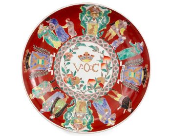
A large Japanese Imari porcelain 'VOC Groningen' dish1800 - 1925
Preis auf AnfrageZebregs & Röell - Fine Art - Antiques
Unbekannter Künstler
EINE SAMMLUNG VON VIER SRI LANKAN IVORY BIBELKÄSTCHEN18th century
Preis auf AnfrageZebregs & Röell - Fine Art - Antiques
Unbekannter Künstler
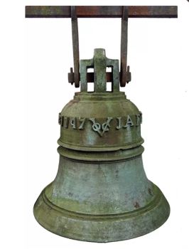
The bell of the VOC fortress in Jaffna, Sri Lanka1747
Preis auf AnfrageZebregs & Röell - Fine Art - Antiques
 Kuratiert von
Danny Bree
Shiba Kokan
Gemälde eines Fantasy-Holländersearly 19th
Preis auf AnfrageZebregs & Röell - Fine Art - Antiques
Unbekannter Künstler
A silver spoon commemorating Juff’ Margareta van Hoorn1656 - 1694
Preis auf AnfrageZebregs & Röell - Fine Art - Antiques
1 - 4 / 24Engelbert Kaempfer
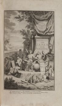
ENGELBERT KAEMPFER BOOK1651 - 1716
Preis auf AnfrageZebregs & Röell - Fine Art - Antiques
1 - 4 / 24- 1 - 4 / 12


