Joan Blaeu (1596-1673), wurde am 23. September 1596 in Alkmaar geboren.
Er war ein niederländischer Kartograph, der in Alkmaar geboren wurde. Er trat in die Fußstapfen seines Vaters, des Kartografen Willem Blaeu.
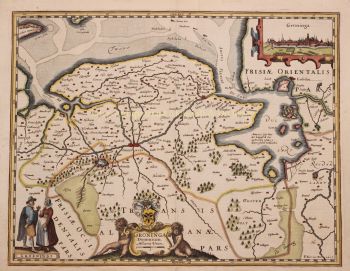
1620 wurde er promovierter Jurist, trat aber in das Werk seines Vaters ein. 1635 veröffentlichten sie den Atlas Novus (vollständiger Titel: Theatrum orbis terrarum, sive, Atlas novus) in zwei Bänden. Joan und sein Bruder Cornelius übernahmen das Atelier nach dem Tod ihres Vaters im Jahr 1638. Joan wurde der offizielle Kartograf der Niederländischen Ostindien-Kompanie.
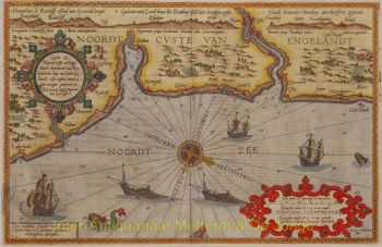
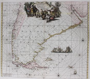
Blaeus Weltkarte Nova et Accuratissima Terrarum Orbis Tabula, die die Entdeckungen von Abel Tasman enthält, wurde 1648 veröffentlicht. Diese Karte war insofern revolutionär, als sie „das Sonnensystem gemäß den heliozentrischen Theorien von Nicolaus Copernicus darstellt, die zeigen, dass sich die Erde um sie dreht die Sonne .... Obwohl Kopernikus' bahnbrechendes Buch "Über die Revolutionen der Sphären" erstmals 1543 gedruckt wurde, war Blaeu etwas mehr als ein Jahrhundert zuvor der erste Kartograph, der diese revolutionäre heliozentrische Theorie in eine Weltkarte einfließen ließ."
Blaeus Karte wurde für die Weltkarte kopiert, die 1655 in das Pflaster des Groote Burger-Zaal des neuen Amsterdamer Rathauses eingelassen wurde, das vom niederländischen Architekten Jacob van Campen (heute Amsterdamer Königspalast) entworfen wurde.
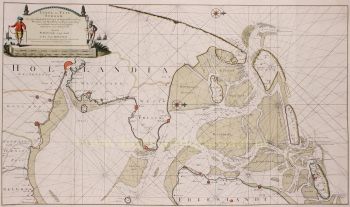
Blaeus Hollandia Nova wurde auch in seinem 1659 erschienenen Archipelagus Orientalis sive Asiaticus im Kurfürsten-Atlas (Atlas des Großen Kurfürsten) abgebildet. und von Melchisédech Thévenot zur Erstellung seiner Karte Hollandia Nova – Terre Australe (1664) verwendet.
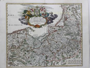
Als „Jean Blaeu“ veröffentlichte er auch den 12-bändigen „Le Grand Atlas, ou Cosmographie blaviane, en laquelle est Exactement descritte la terre, la mer, et le ciel“. Eine Ausgabe ist auf 1663 datiert. Das war Folio (540 x 340 mm) und enthielt 593 gestochene Karten und Tafeln. Im März 2015 wurde eine Kopie für 750.000 £ verkauft.
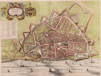
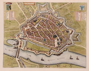
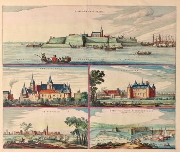
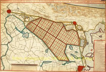
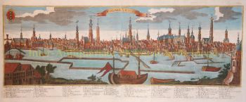
Um 1649 veröffentlichte Joan Blaeu eine Sammlung niederländischer Stadtpläne mit dem Titel Toonneel der Steeden (Ansichten von Städten). 1651 wurde er in den Amsterdamer Rat gewählt. 1654 veröffentlichte Joan den ersten schottischen Atlas, der von Timothy Pont entworfen wurde. 1662 gab er den Atlas Novus, auch bekannt als Atlas Maior, in 11 Bänden und einem für Ozeane neu heraus.
Als nächstes Projekt war eine Kosmologie geplant, doch 1672 zerstörte ein Brand das Atelier vollständig.
Joan Blaeu starb im folgenden Jahr, 1673, in Amsterdam. Er wurde in der Westerkerk in Amsterdam begraben.


![RARE ARMORIAL MAP: LEO BRABANTIAE Lion of the most noble Duchy of Brabant] by Sibertus Waterloos](https://media-3.gallerease.com/images/325cc033-a3b6-495f-9da8-6d06caf29b14/350x350/rare-armorial-map-leo-brabantiae-lion-of-the-most-noble-duchy-of-brabant.jpg)